
Master's in Polar Exploration and Ice Navigation
This master's programme prepares you to lead expeditions and maritime operations in the most challenging environments on the planet. You will work with ice science, ice classes, route selection and the Polar Code, including logistics, emergency preparedness and environmental protection.
Prior knowledge check
These are the skills this programme gives you. Tick the ones you already master and we will tell you which part of the syllabus is for you.
You are starting from scratch in this subject. The programme is designed precisely for that.
What is the Master's in Polar Exploration and Ice Navigation?
This master's degree prepares you to lead expeditions and maritime operations in the most demanding polar environments. It covers the interpretation of satellite imagery, navigation in ice conditions, planning safe routes, polar ecology, climate change and the international regulation that applies to these regions.
The programme stands out for its simulation exercises, in which you practise ice navigation scenarios; its expedition planning skills, so you can plan and carry out safe and efficient expeditions; its coverage of cutting-edge navigation, communication and ice monitoring technologies; and its sustainable impact, contributing to the research and conservation of polar ecosystems.
Programme highlights
- Cutting-edge techniques: tools and methodologies for polar exploration and data analysis in extreme environments.
- Safe navigation: navigating in sea ice using chart interpretation and advanced equipment.
- Environmental impact: the study of climate change and its effect on the polar regions.
- Leading-edge research: applied projects in polar science and technology.
- Career opportunities: openings in scientific institutions, exploration companies and environmental consultancy.
- Become an expert in the challenges of the Arctic and Antarctica.
Syllabus of the Master's in Polar Exploration and Ice Navigation
11 modules. Select a module to see its content.
Advanced Navigation and Survival Techniques in Extreme Polar Environments
- 1.1. Advanced polar route planning models: analysis of environmental variables, sea ice forecasting and polar maritime traffic
- 1.2. Operation of high-latitude positioning systems: GNSS-GLONASS-Galileo in polar environments, error mitigation and convergence techniques
- 1.3. Specialised cartography for ice navigation: interpretation of ice charts, advanced symbology and analysis of SAR satellite maps
- 1.4. Navigation in sea ice: continuous monitoring, use of ice charts and criteria for adopting safe routes through fractured ice and icing conditions
- 1.5. Pilotage techniques in restricted waters and glacial channels: precision manoeuvres, use of radar and echo sounders to avoid grounding and collision risks
- 1.6. Survival in extreme conditions: emergency protocols, advanced use of personal protective equipment and temporary shelters in polar environments
- 1.7. Communication and coordination in remote environments: satellite systems, HF/VHF radio protocols and multichannel link platforms
- 1.8. Risk management and decision-making under environmental stress: application of CRM (Crew Resource Management) methodologies adapted to polar expeditions
- 1.9. Assessment and mitigation of physical impacts: hypothermia, frostbite and dehydration; specialised first aid in freezing environments
- 1.10. Practical simulations of polar navigation failure scenarios: sensor failure, extreme loss of visibility and tactical emergency response
Positioning Systems and Dynamic Cartography for Safe Operations in Extreme Polar Environments
- 2.1. Advanced fundamentals of global navigation satellite systems (GNSS) in polar environments: differences and limitations between GPS, GLONASS, Galileo and BeiDou in high-latitude conditions
- 2.2. Dynamic polar cartography: real-time updating techniques and adaptation to sea ice movement and deformation using remote sensing and Earth observation satellites
- 2.3. Integration of inertial and satellite systems for navigation in areas with temporary GNSS signal blockage due to atmospheric or ionospheric phenomena
- 2.4. Numerical models and predictive algorithms for ice cartography: simulation of ice drift, fracturing and compaction to anticipate risks on navigation routes
- 2.5. Implementation and calibration of LIDAR sensors and ice-penetrating radar (GPR) for sub-surface mapping and detection of submerged hazards
- 2.6. Advanced use of ECDIS specific to polar navigation: handling extended ENC charts with dynamic hydrographic data and environmental information layers (ice thickness, currents, temperature)
- 2.7. Redundancy and contingency protocols for electronic positioning systems in multiple-failure scenarios, including traditional navigation techniques combined with modern systems
- 2.8. Data communication and synchronisation with land-based and satellite operations centres for collaborative real-time updating of charts and safe routes
- 2.9. Early warning systems and automatic route control to avoid high-risk areas such as active cracks, polynyas and moving ice leads
- 2.10. Legal and regulatory aspects of dynamic cartography in polar areas: compliance with international standards and protocols for the exchange of cartographic information in protected areas
Advanced Strategies in Navigation and Survival in Extreme Polar Environments
- 3.1. Polar climate dynamics and their impact on navigation planning: atmospheric systems, katabatic winds, freeze and thaw cycles
- 3.2. Advanced sea ice forecasting models: ice types, formation, drift and thickness estimation using satellite sensors and SAR radar
- 3.3. Specialised cartographic tools for icy areas: polar nautical charts, refraction corrections and adaptations to seasonal changes
- 3.4. Routeing strategies and risk management for navigation through ice fields: polygonal analysis, ramming navigation and use of icebreakers as escorts
- 3.5. Survival and life support in extreme conditions: advanced management of hypothermia, frostbite, dehydration and altitude disorders
- 3.6. State-of-the-art equipment and technology for monitoring and communication in isolated environments: satellite transmitters, polar GLONASS/GNSS systems and emergency devices
- 3.7. Manual and automated pilotage techniques in ice: integration of ultrasonic sensors, echo sounders and lidar for safe and accurate navigation
- 3.8. Emergency and rescue procedures in remote polar environments: establishing evacuation routes, safe zones and inter-agency coordination protocols
- 3.9. Analysis of real cases and computer simulations for decision-making in unforeseen events: ice collapses, whiteouts and mechanical failures
- 3.10. International standards and specific regulations for operations in polar areas: compliance with environmental treaties and protocols for the protection of vulnerable ecosystems
Route Planning and Manoeuvring in Ice, Expedition Logistics and Polar Emergency Response
- 4.1. Fundamentals of route planning in polar environments: assessment of weather conditions, ice state and oceanographic factors
- 4.2. Specialised cartography of Arctic and Antarctic regions: interpretation of topographic, bathymetric and ice thickness charts
- 4.3. Predictive models of ice drift and concentration: integration of satellites, icebreakers and instrumented buoys
- 4.4. Design of safe passages: selection of optimal routes considering dynamic ice behaviour and the vessel's operational limitations
- 4.5. Advanced logistics for polar expeditions: provisioning, fuel and resource management, equipment preparation and life-support systems
- 4.6. Communication systems in remote areas: use of satellites, HF/VHF radio and transmission protocols in adverse conditions
- 4.7. Methodologies and protocols for polar emergency response: activation of contingency plans, ice rescue, medical evacuation and international cooperation
- 4.8. Risk assessment and mitigation: analysis of natural hazards (moving ice, cracks, storms) and technological hazards (navigation system failures)
- 4.9. Implementation of emergency exercises and drills: roles, responsibilities and coordination with land and air teams
- 4.10. Post-operational documentation and reporting: incident analysis, adjustment of procedures and continuous improvement in polar exploration and navigation
Emerging Technologies in Risk Detection and Crisis Management for Safe Operations in Glacial Conditions
- 5.1. Fundamentals of advanced risk detection: smart sensors and remote sensing in glacial environments
- 5.2. LIDAR and ground-penetrating radar (GPR) technologies: applications for mapping crevasses, caverns and internal ice structures
- 5.3. Satellite monitoring systems and UAVs (drones) equipped with thermal and multispectral sensors for real-time analysis
- 5.4. Artificial Intelligence and Machine Learning in the prediction and modelling of critical events: ice avalanches, fracturing and rapid displacements
- 5.5. Distributed sensor networks and IoT systems for early detection of extreme weather conditions and dynamic changes in the ice mass
- 5.6. Integrated crisis management platforms: development and implementation of interoperable systems for coordinating teams and resources
- 5.7. Advanced communication protocols in polar areas: high-speed satellite links, HF and UHF radio for extreme environments
- 5.8. Simulation and virtual training with augmented reality for incident response in polar navigation and on-ice operations
- 5.9. Risk mitigation strategies based on big data and geospatial analysis for route optimisation and tactical decision-making
- 5.10. International regulations and technical standards applicable to operational safety and crisis management in polar regions
Advanced Positioning Systems and Dynamic Cartography for Safe Navigation in Extreme Polar Environments
- 6.1. Fundamentals of global navigation satellite systems: architecture, GNSS signals, GPS, GLONASS, Galileo and BeiDou constellations
- 6.2. GNSS errors and corrections: ionospheric, tropospheric, multipath, satellite clock and post-processed correction
- 6.3. Differential GNSS and satellite-based (SBAS) and ground-based (GBAS) augmentation; critical applications in polar navigation
- 6.4. Sensor fusion integration: INS (inertial navigation system), gyroscopes, accelerometers and odometers for redundancy and accuracy in ice
- 6.5. Dynamic cartography: fundamentals, generation, real-time updating and management of cartographic databases specific to polar regions
- 6.6. Cartographic specificities of polar environments: map projections, distortions, isobaths and representation of ice formations
- 6.7. Advanced use of polar ECDIS with ENC/S-57, S-63 data and dynamic layers for safe navigation in sea ice and glaciers
- 6.8. Communication and synchronisation protocols between navigation systems and external sensors: radar, AIS, multibeam echo sounder and meteorological sensors
- 6.9. Fault detection and troubleshooting in positioning systems and electronic charts; maintenance and contingency procedures at high latitude
- 6.10. Environmental impact and IMO regulations specific to navigation in polar areas: integration into route planning and monitoring systems
Route Planning, Ice Manoeuvring and Emergency Management Strategies in Extreme Polar Environments
- 7.1. Fundamentals of route planning in polar environments: analysis of specific meteorological, oceanographic and geographical variables
- 7.2. Assessment and mitigation of operational risks: identification of hazards associated with sea ice, cracks, ice floes and extreme atmospheric conditions
- 7.3. Predictive models and advanced tools for selecting safe tracks: geographic information systems (GIS), satellites and numerical ice modelling
- 7.4. Navigation techniques and manoeuvres in ice: interpretation of ice types, dynamic behaviour of floes and navigation in leads and polynyas
- 7.5. Design and execution of ice-breaking and ice-avoidance manoeuvres: forces exerted on the hull, helm control and constant route monitoring
- 7.6. Operations in low visibility and extreme weather: adaptation of navigation equipment, lookout procedures and assistance technologies
- 7.7. Communication and coordination protocols with polar stations and logistics support units
- 7.8. Integrated emergency planning and management: common and complex incident scenarios in polar environments, including structural damage, spills and loss of propulsion
- 7.9. Organisation of rapid response teams and allocation of roles during critical incidents
- 7.10. Emergency management simulations and case studies: search and rescue on ice, evacuation, treatment of hypothermia and survival in extreme conditions
Polar Climate Dynamics and their Impact on Safe Navigation and Route Optimisation over Ice in Extreme Environments
- 8.1. Polar atmospheric processes: high- and low-pressure systems, polar vortices and the formation of winter storms at extreme latitudes
- 8.2. Ice-atmosphere interaction mechanisms: albedo feedback, thermal subsidence and dynamic subsidence in the boundary layer
- 8.3. Numerical climate models applied to polar forecasting: parameterisation of complex processes and validation with satellite data and in situ campaigns
- 8.4. Sea ice dynamics: types, seasonal distribution and interannual variability, including analysis of thickness, salinity and drift
- 8.5. Polar ocean currents and their influence on ice drift: interaction with multi-year ice systems and new patterns emerging from climate change
- 8.6. Impact of thermal anomalies on the formation of cracks and fractures in solid ice fields and their implications for passage safety
- 8.7. Application of remote sensors and remote sensing for real-time monitoring of climatic conditions and ice state: interpretation of SAR data, laser altimetry and microwave radar
- 8.8. Advanced strategies for route optimisation in the presence of mobile and dynamic ice: adaptive navigation algorithms and probabilistic forecasting systems
- 8.9. Assessment of extreme meteorological risks and their mitigation through operational protocols and decision-making based on integrated predictive models
- 8.10. Implications of polar climate change for maritime route planning: increased accessibility versus new emerging hazards
Advanced Navigation and Risk Management Strategies in Extreme Polar Environments
- 9.1. Dynamics and characteristics of polar environments: ice formation, sea ice and extreme weather conditions
- 9.2. Advanced models for navigation in glacial waters: assessment and adaptation of routes according to ice drift and fracture
- 9.3. Strategic planning of the polar passage: analysis of optimal routes considering weather windows and ice conditions
- 9.4. Management of risks specific to polar navigation: assessment, mitigation and contingency protocols for environmental and operational threats
- 9.5. Interpretation and use of satellite and sensor technologies: polarimetric RADAR, LIDAR and optical systems for ice navigation
- 9.6. Integration of navigation support systems: specialised ECDIS for polar areas, ice navigation alerts and dynamic data management
- 9.7. Safe operation and planning in low-temperature conditions: prevention of technical failures in navigation equipment and machinery
- 9.8. Communication and coordination in remote environments: emergency protocols, satellite links and coordination with land bases
- 9.9. Advanced ice navigation simulation for real-time decision-making and handling of critical situations
- 9.10. Post-operational evaluation and analysis of lessons learned for continuous improvement in risk management and operational efficiency in polar environments
Polar Code, Regulations and Certification of Ships for Polar Waters
- 10.1. International Code for Ships Operating in Polar Waters
- 10.2. Polar ship categories A, B and C
- 10.3. IACS Polar Classes
- 10.4. Polar Water Operational Manual (PWOM)
- 10.5. STCW training for navigation in ice
- 10.6. Polar survival equipment
- 10.7. POLARIS risk assessment system
- 10.8. Environmental protection in polar waters
- 10.9. Antarctic Treaty and regulation of expeditions
- 10.10. Polar Ship Certificate
Master's Thesis: Integration of Innovative Technologies for Exploration and Navigation in Extreme Polar Environments
- 11.1. Fundamentals and new developments in remote sensing systems for ice: SAR radar, LIDAR and hyperspectral sensors applied to high-resolution polar cartography
- 11.2. Integration of multi-frequency GNSS technologies and inertial navigation systems for reliable positioning in Arctic and Antarctic environments with extreme conditions
- 11.3. Advanced dynamic sea ice forecasting models: machine learning algorithms for real-time estimation of thickness, fractures and spatial distribution
- 11.4. Implementation and analysis of satellite communication and HF radio systems adapted to polar latitudes to ensure secure links on remote exploration missions
- 11.5. Design and evaluation of specialised vessels with automatic assisted navigation systems for safe transit through fields of variable ice and moving floes
- 11.6. Multi-sensor data fusion protocols to improve situational awareness: integration of meteorological, oceanographic and ice information for strategic decision-making
- 11.7. Autonomous underwater and aerial platforms for intervention and reconnaissance in inaccessible areas: deployment, remote control and operational data analysis
- 11.8. Advanced simulation tools for training in extreme polar scenarios: risk modelling, evasive manoeuvres and critical climatic contingencies
- 11.9. Evaluation of specialised software for route planning and avoidance of dynamic obstacles in polar navigation: adaptive algorithms and early warning systems
- 11.10. Detailed study of international regulations and technical standards applied to technological integration in polar expeditions: legal compliance and best practices
Duration and format of the Master's in Polar Exploration and Ice Navigation
It is 1,500 hours. Tell us how many you can study each week and we will tell you when you will really finish.
This is the pace at which most students finish. It fits well with the instalment plan.
Academic leadership and faculty
The Navalis teaching team: working professionals who teach and supervise the programmes.
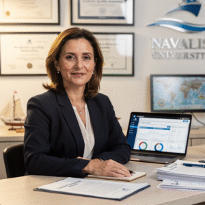 Dra. Marina AlcoverAcademic Director and Head of Quality Assurance
 Ing. Diego CifuentesSenior Lecturer in Naval Welding and Non-Destructive Testing; Head of QA/QC for Welded Joints
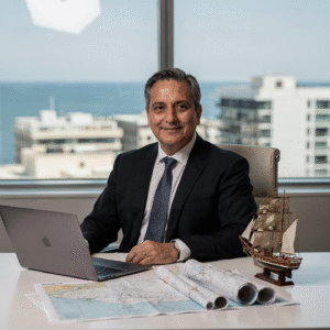 Cap. Javier Abaroa (MCA)Senior Lecturer in Ship Handling, Electronic Navigation (ECDIS/Radar/ARPA) and GMDSS; STCW Compliance and Bridge Resource Management Coordinator
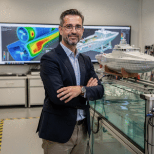 Dr. Pau FerrerSenior Lecturer in Naval Architecture and Simulation; Director of the Hydrodynamics and CFD Laboratory
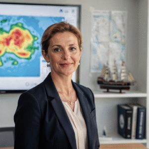 Dra. Nuria LlobregatSenior Lecturer in Marine Meteorology, SAR and Operational Safety; Navigation Risk Management Coordinator
 Ing. Javier BañulsSenior Lecturer in Electrical Engineering, Automation and ETO Engineering; Electronic Integration and Engine Alarms Coordinator
 Ing. Sofía MarquinaSenior Lecturer in Materials, Composites and Corrosion Protection; Coordinator of the Advanced Paints and Coatings Line
 Ing. Tomás RieraSenior Lecturer in Propulsion, Alternative Energy and Hybrid Systems; Energy Performance and Vibration Coordinator
Objectives of the Master's in Polar Exploration and Ice Navigation
Career opportunities after the Master's in Polar Exploration and Ice Navigation
Questions about the Master's in Polar Exploration and Ice Navigation
Yes.
Yes. The pathway includes ECDIS/Radar-ARPA/BRM with port, ocean, fog, heavy weather and SAR scenarios.
Online with live sessions; hybrid option for simulator/placement periods through partnership agreements.
Both.
Functional SMCP is recommended. We provide support materials for standard phraseology.
Yes, with a related qualification or experience in maritime/port operations. The admission interview will confirm suitability.
Optional (3–6 months) through Companies & Partnerships and the Alumni Network.
Simulator exercises (rubrics), passage plans, SOPs, checklists, micro-tests and an applied master's thesis.
More programmes in Bridge and navigation
Admission process
No waiting for a call back. If your documents are in order, you can enrol in the same session.
- Academic or professional profile: a degree in science, engineering, nautical studies or a related field, or accredited experience in polar expeditions, maritime navigation or research in cold regions.
- Language skills: technical and scientific English at B2 or higher is recommended.
- Documentation: up-to-date CV, qualifications, academic transcript, identity document or passport, a motivation letter and, optionally, letters of recommendation.
- Technical requirements (online): a computer with camera and microphone, a stable connection, video-conferencing software and data analysis software according to your specialisation. Enrolment is open all year round; admission is provisional until the committee validates your documentation.
- 01ApplicationYour details, background and documents.
- 02Instant reviewWe check that everything is complete and in order.
- 03EnrolmentChoose full payment or instalments and reserve your place.
Admission is provisional until the committee validates the documents provided. If you do not meet the requirements, the full amount is refunded.
Ask us before you enrol
Leave your details and admissions will write to you to answer any questions. If you are already sure, you can apply and pay in the same session.